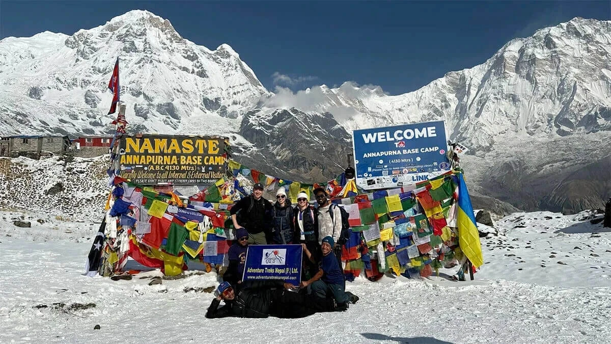
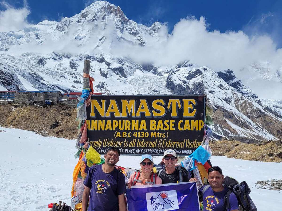
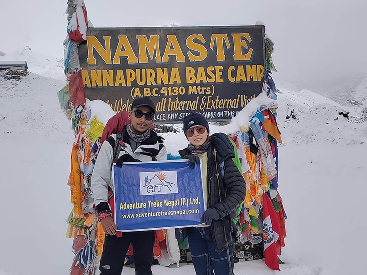
Several adventure seekers dream of reaching the base of Mt. Annapurna (8091 m), experiencing both rewards and challenges through diverse terrain in the heart of the mid-western Himalayan ranges. A route map is essential for a successful journey because strategic planning starts with observing major hiking trails, initial points, rest stops, walking distances, highlights, and elevation profiles.
Explore highlights such as Ghore Pani Poon Hill (3210 m), Annapurna Base Camp (4130 m), Ghandruk, and Jhinu Danda, depending on the chosen itinerary. While making your steps through the Annapurna Conservation Area, spot endangered wildlife playing in their hamlets filled with various plants. With the detailed information, you will not miss most awe-inspiring vistas of mountain ranges like Annapurna, Dhaulagiri, Machhapuchhre, Gangapurna, Tent Peak, and Hiuchuli.
To follow legendary mountaineers’ footsteps and to leave your footprints there on the Annapurna trails without confusion of right turns, read this latest blog, which tells of the necessity of the Annapurna Base Camp trek map, which helps trekkers understand the trail’s direction, elevation gain, and route options.
Why do you need a map to trek to Annapurna Base Camp?
While knowing the details about trails, trekking agencies can also tailor a smooth itinerary that suits all levels of trekkers. Accordingly, the Annapurna Base Camp route map is in your packing list, although a seasoned guide accompanies you throughout the odyssey for confirmation that you have stepped in the right direction and traversed as per the day scheduled.
Savoring the charm of towering, snow-clad mountains, you will navigate the path safely by estimating the time to reach the destination. With the knowledge of the trail and predicted weather conditions of the places, you can make the journey unforgettable. In addition, you will enjoy it to the fullest without the challenges, including the case that leads you to return midway due to a lack of alternative ways if the major Annapurna trekking path gets blocked.
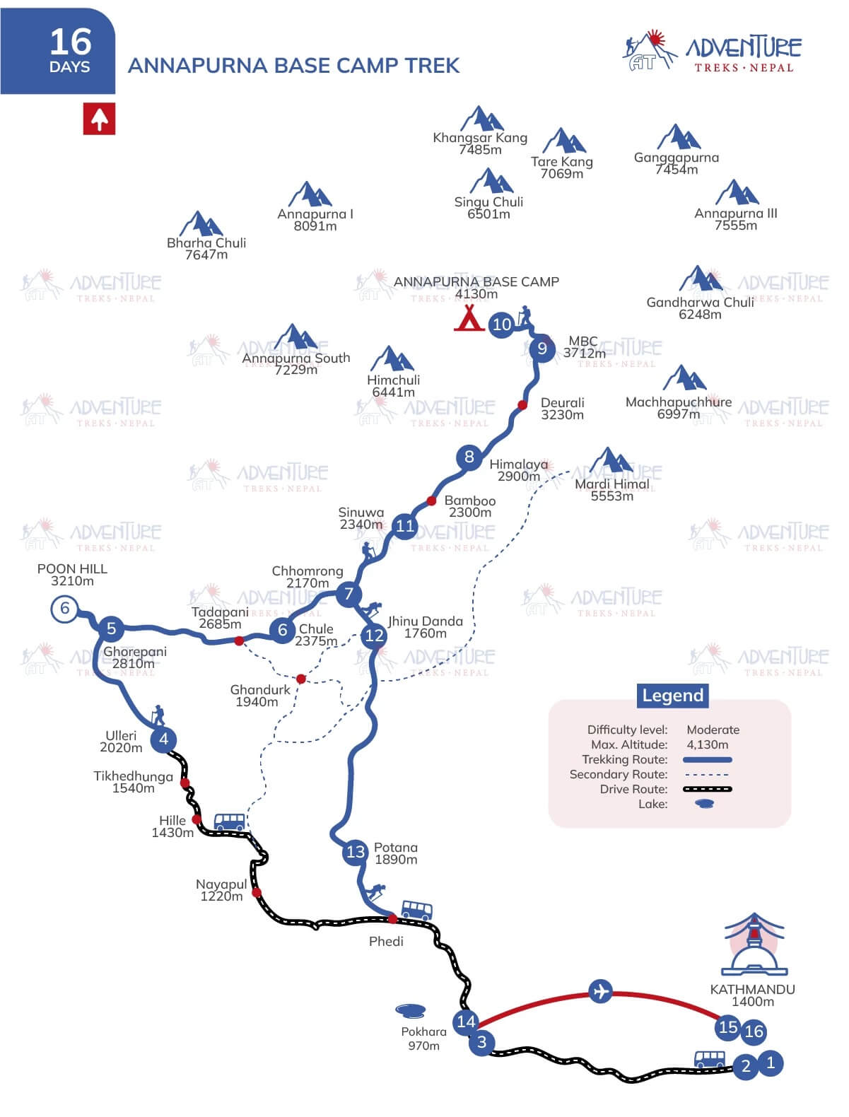
16 Days Annapurna Base Camp Trek Map
For more clarity, check the following points, which give you reasons to keep the Annapurna trail map with you while walking.
How does an Annapurna Base Camp Trek map help to select the best route?
Each Annapurna trail map provides an in-depth understanding of the trails, including the Elevation Profile of the Annapurna Base Camp Trek and all available routes, allowing you to easily identify longer or shorter trails as well as major or alternative options based on your needs. Accordingly, the detailed map guide is not only a navigation tool but also a way to choose the best route to Annapurna Base Camp.
It will be easier for you to plan for the trip by comparing paths such as the classic (Nayapul-Ghorepani-Chhomrong route) or the shorter one through Jhinu Danda based on initial/ending points, total trekking distance and duration, and transportation accessibility by road.
Can a map help you measure the daily trekking distance of the Annapurna route?
Most trekking agencies, including us, provide a clear map together with cost, itinerary, and essential information in a package by indicating initial/ending points, pausing spots, trekking routes, alternative hiking trails, driving routes (showing pictures heading to the trekking region and returning to Kathmandu), highlights, lakes, and difficult terrain. In a similar way, a detailed map for Annapurna Base Camp displays the maximum elevations for each day to indicate elevation gains or losses, and it also illustrates the trekking distances between villages.
Plan your journey precisely with the Annapurna trekking route guide to reach the destination on time as you collect ideas for ascents and descents by observing elevations, the difficulty of the paths, and distances. Adjusting your walking rhythm and rest breaks according to the difficulty and elevation of each landmark will help you avoid physical and mental exhaustion. Ensure smoother hiking experiences throughout the Annapurna Base Camp route, as the map not only helps check your daily progress but also guarantees better time arrangement and acclimatization.
Is it easier to find teahouse locations with the help of the ABC route map?
Yes, you will surely find the Annapurna Base Camp trekking more convenient with a route map because of the clearly marked pausing stops, popular teahouses, and major villages along the trails. Except during off-seasons like the monsoon and winter, these restaurants and guesthouses are always ready to provide services to protect tourists like you from the harsh cold at high altitudes and to save you from other incidents. Locals descend to the lower settlements as the monsoon brings heavy rains to many regions of Nepal, causing landslides and floods.
Similarly, most teahouses will not open during the winter as owners migrate to other places with lower elevations to be safe from freezing temperatures that may cause severe health issues. Therefore, during these seasons, you may need to compromise on which teahouses to stay at, even if you prefer certain ones, as the map shows limited options available. However, the same thing might happen during trekking seasons due to high demand for accommodations and food.
Ensure that your Nepal trekking guide has already done pre-booking for reliable teahouses to trek without the stress of overnight stays after covering the predicted distances in a day. You can also take the map in your hand to select places to stay, saving time and energy in search of the best resting points on the ABC trek. While choosing a place like this, you will not miss breathtaking scenery and cultural immersion, together with affordable rooms and services.
How can you stay alert on the Annapurna route due to the trek map?
Even though most trekking trails in the Annapurna region are well marked, you might face unpredictable circumstances while heading to your destination without knowing the trail conditions. Accordingly, keep the Annapurna Base Camp Trek Map with you, which helps you to select an alternative way in case the major trail gets blocked due to natural disasters or reconstruction, avoiding the risks of getting lost and injured.
However, the map not only makes you alert, considering the safety of the ABC path, but also helps in arranging movement pace and strength while traversing through diverse terrain with various ecosystems. In isolated hiking areas with poor signage and confusing trails, a map plays a vital role by instructing you to follow the right one. Make your journey more incredible in the serenity of the region, building confidence for crossing every stage of the trek, with essential hiking equipment for the high-altitude Himalayas.
When to check the map before Annapurna Trekking?
Packing without missing any single crucial thing for a Himalayan adventure is another challenge before beginning to step forward to the destination. A must-have thing in the checklist is the Annapurna Base Camp route map to ensure a safe and efficiently arranged trip, as a detailed map gives you an overview of the hiking paths.
Therefore, the Annapurna trekking route guide suggests you keep it with you until the journey is complete, as it becomes much smoother while getting a visualization of the topography. You can train for challenging parts and elevation challenges and get ready for hiking locations that correspond with your level of fitness.
What should you check on the Map before the ABC trek?
When you arrive at either Nayapul or Jhinu Danda after a thrilling road ride from the city of Pokhara, depending on your Annapurna Base Camp trek itinerary map, it’s crucial to review the rest points, nearby settlements, and elevation gains along the route before you start trekking. Likewise, check your map each day to note the distance between your initial point of the trek and the day’s destination. With knowledge about such things, you can estimate walking hours and maintain a balanced trekking pace.
Have the map ready at all times so you don’t miss major highlights such as Ghorepani Poon Hill for its stunning sunrise view, Jhinu Danda for relaxing in the natural hot springs, and Chhomrong, one of the most wonderful spots for acclimatization before heading towards the base camp (4130 m).
Is it necessary to keep checking the map during the Annapurna trek?
Yes, reviewing the Annapurna trail map of your trekking route regularly not only ensures that you are continuing to walk on the right trail but also measures your daily progress, especially in trekking sections without directional signs or eye-catching trail markers. Keeping up to date on trail conditions and staying aware of the route will enhance your entire experience on the Annapurna trek, raising your confidence level rather than increasing the difficulty during some steep ascents and fast technical descents.
We recommend checking your position daily using a GPS device or a printable Annapurna Base Camp route map. This ensures you stay on the right paths depending on the itinerary, avoiding wrong turns while heading toward your daily destination.
How to choose a map for the Annapurna Base Camp Trek?
While selecting the map for trekking to the Annapurna Base Camp, carefulness is important, as in other preparations. Ensure that your map includes all the elements necessary for safe navigation through the diverse terrain of the Annapurna region. However, check the following things to choose the best Annapurna Base Camp trekking itinerary map.
Why should you check the scale and clarity of the Annapurna Base Camp Trek Map?
If a map has several mistakes, including village names, initial points, and elevation, hikers cannot make good preparations, which results in health risks. Accordingly, we suggest checking that the Annapurna Base Camp route Map is capable of helping you read the mountain slopes and elevation patterns with clear scale information.
Since an unreliable map creates challenges to plan each day’s walking to cover appropriate distances effectively, you should ensure your safety and comfort by identifying every danger zone, including avalanche-prone areas, landslide-risk territory, and steep terrains.
How can an ABC trek map with updated trail conditions be more beneficial?
Although most Annapurna trails are better marked than off-the-beaten-path treks like Kanchenjunga and Manaslu, make sure to check that a map mentions the current conditions. This information on the paths will make it easier for you to avoid the rare case of returning to Kathmandu due to a barrier on the way to the Annapurna Base Camp. Occasionally, you may need to choose a more strenuous alternative trail, which can increase the risk of injury.
Consequently, stay updated about the trekking route so you can plan the trip wisely if the chosen path is in the process of being maintained for safer hiking. Strategically prepare to make your dream come true, avoiding the outdated Annapurna Base Camp Trek Map.
How does a different route impact a Trekking Map for the Annapurna?
Trekking agencies in Nepal have different packages for the same destination, including the Annapurna Base Camp, due to hiking route variations. To identify clearly both the starting and finishing points, including any drive segments. Ensure that the provided detailed map for Annapurna Base Camp has clear marks indicating routes and teahouses to save your time.
Do clear elevation profiles on the Annapurna trekking map support you?
The Annapurna Base Camp trail takes you up to 4130 m, traversing high settlements like Chhomrong and Deurali. Therefore, trekkers need to develop mental and physical strength while walking through the lush subtropical landmarks to the alpine meadows with higher elevations. Above 2500 m, you experience the symptoms of acute high sickness, like headache, nausea, dizziness, sleeping difficulty, and shortness of breath.
If the map clearly presents each place’s elevation, trekkers can be more cautious near villages with lower levels of oxygen, avoiding harsh situations due to high-altitude-related problems. Although you have packed the Annapurna Base Camp trek map with elevation, ensure that your guide has expertise in medicating these types of health issues and has a first aid kit, including medicine like “Diamox. Therefore, trekkers should ensure that the map has an elevation Profile of the Annapurna Base Camp Trek.
Is the Annapurna Base Camp trekking possible without a map?
A fully trained Nepal trekking guide knows each place’s weather, major or alternative trail, and dangerous territory, even if he has no route map to the Annapurna Base Camp. Nevertheless, a journey with no outline to navigate hiking paths with updated conditions means an increased risk of challenges. While observing previous news, several trekkers got lost and have even lost their lives in such situations due to the delay of rescue in poorly signed trekking areas with weak networks, although they had a map.
Considering each trekker’s safety, solo trekking in any region is no longer possible these days. A seasoned guide accompanies you the entire journey, helping you to cross the steps of the trek. Only having the Annapurna Base Camp trek map with elevation is not enough, as it requires an expert guide to understand the map’s instructions. Nevertheless, do not miss it, as it plays a vital role in every section of the journey.
How Can You Access the Annapurna Base Camp Map?
Generally, local travel companies conducting the Himalayan adventures in Nepal, including Annapurna region trekking, will provide a map for the chosen route together with some equipment. Adventure Treks Nepal also provides the Annapurna Base Camp trek map for you to confirm that you are proceeding, depending on the itinerary.
Likewise, the Annapurna Conservation Area Permit Office, Pokhara, or the Nepal Tourism Board office, Kathmandu, can also provide downloadable maps for trekking to various routes in the Annapurna, Langtang, and Everest regions. If you check on Google, you will get online sources for the route map, which are either printable or digital GPS.
Which type of Annapurna Base Camp route Map is better?
Whether it is a traditional topographic map, offline map files, online maps, or Nepal-based hiking apps, all types have their own advantages for guiding you in high altitudes. While advanced GPS tools will support you with live location tracks, a printed version of the trekking map with an elevation profile will be more effective for remote areas with no electricity or internet access. It’s on you to select the best for you, which will be the most trustworthy, without missing any crucial information.
If you see the Annapurna Base Camp Trek Map of Adventure Treks Nepal, we have designed a detailed map with clear displays of rivers, lakes, woodland sectors, mountains, villages, rest points, and glaciers on the route. If you do not want to take the stress of the battery to see the route through an electronic device, the printed one is best when the internet also fails to connect. Nevertheless, ensure that the map is waterproof, long-lasting, durable, and detailed.
Trekking websites provide numerous downloadable maps for trekking, while digital map tools such as SW Maps, Hiiker App, Gaia GPS, and GPS Nepal have become appropriate digital tools. Trekkers have been using some of them during Himalayan adventures in high-elevation areas. Although these maps make it easier for you with real-time GPS tracking, download maps for offline use before venturing on the journey, as many areas of the Annapurna region still have limited or no internet services.
Carry extra batteries and a lightweight charger, and also use battery-saving modes, as you know that portable smart devices can lose power quickly in harsh cold weather. Do not depend only on advanced tools for navigating, as you have alternative options like a printed version of the map and a compass for ease. Moreover, take your step ahead only after consulting with your trekking guide, and also know the current conditions of the trail with locals.
Conclusions
To sum up, make your dream come true with the best Annapurna trekking route guide in 2026/2027 by joining us as we provide a licensed guide with many years of experience in trekking and tourism. We provide you with a detailed map (both digital and printed) to make your journey safer. Since the daily trekking distance and the Annapurna Base Camp elevation are mostly searched on websites, we have provided some guidance on the route to let you know that a map is key to getting information about such things.
14 days of Annapurna Base Camp trekking can be best for you to enjoy nature with gradual ascents and descents without skipping major highlights on the trails. Hurry up for the trip as bookings are opening for upcoming peak seasons. For more inquiries, contact us on Whatsapp or email.
FAQs
What permits do you need to trek to the Annapurna Base Camp?
A Trekkers Information Management System (TIMS) card and an Annapurna Conservation Area Permit (ACAP) are essential paper documents to enter the Annapurna region for trekking on the ABC trek route.
When is the best time to trek in the Annapurna region?
Spring (March to May) and autumn (September to November) are optimal periods of the year, although most destinations are doable year-round. The Mardi Himal Trek and Ghorepani Poon Hill Trek are appropriate for winter if you want to enjoy snow with your loved ones. Likewise, Upper Mustang and Narphu Valley are most preferred for the Monsoon as they lie in rain-shadow areas.
What to eat on the Annapurna Base Camp trek to stay healthy?
Fresh meals such as “Dal and Bhat” (steamed rice, seasonal green vegetables, pickle, and salad), and sometimes meat, might be the best to have on the Annapurna Trek to keep you energized to cover the daily trekking distance. As snacks, carry dry fruits, nuts, energy bars, biscuits, beaten rice, and cookies for instant power in your body.
Do you need travel insurance to trek to the Annapurna Base Camp?
Yes, you need to obtain travel insurance for the Annapurna trekking to save you from unnecessary expenses on unpredictable incidents, including emergency helicopter evacuation, medical treatments at the hospital, and other cases like personal belongings loss or damage, flight delay, or cancellation.
How difficult is the Annapurna Base Camp trekking?
Annapurna Base Camp Trekking is a moderate journey, which is also accessible to beginners. We have a record of conducting the ABC trek, consisting of a three-year-old child and an elderly member over seventy years old. Therefore, I am ready to trek to the base of Mt. Annapurna with adequate physical and mental preparation. Start doing common cardiovascular exercises as well as meditation to join the remarkable trip as soon as possible.